Draw Maps: Map Notes
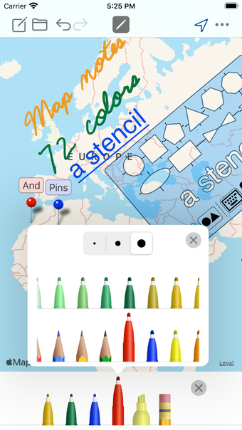
Draw Maps: Map Notes is a free iPhone application developed by Bluefield GIS Inc. It falls under the category of Travel & Navigation, offering users the ability to make sketches and take notes anywhere on a map. With a wide range of color pens and pencils, users can easily draw and highlight important locations.
The app allows users to add map pins and photos to their notes, making it ideal for various purposes. Whether you're planning a vacation, designing landscapes, or recording wildlife sightings, Draw Maps provides a convenient platform. Users can also utilize the app for tracing hiking trails, geocaching, and learning geography by tracing borders.
Featuring 72 colors and a stencil for drawing perfect shapes or labels, Draw Maps offers a comprehensive drawing experience. The ability to move and zoom the map while drawing adds to the app's flexibility. Additionally, users can send images of their map drawings to others and even share their Draw Maps Document with fellow users.
While the basic features of Draw Maps are free, there are also Pro features available for purchase. These include sending KML files and creating unlimited maps. The app is also optimized for use with the Apple Pencil, providing a seamless drawing experience for users.
Overall, Draw Maps: Map Notes is a versatile and user-friendly application that allows users to easily draw, highlight, and take notes on maps, making it a valuable tool for various purposes.